Eminönü - Alibeyköy Tram Line
Land Parcel Identification System
Acquisition and Creation of Orthophotos under Digitisation of Land Parcel Identification SystemBursa Photogrammetric Orthophoto and Asbuilt Project (M5)
Production of 1/1000 and 1/5000 scale Photogrammetric as built Maps and 1/5000 scale Orthophoto Maps within Bursa City Borders (12 000 km2)İstanbul Photogrammetric Revision Asbuilt Project
Production of 1/1000 and 1/5000 scaled Photogrammetric Revision as built Maps and 1/5000 Scaled Orthophoto Maps within İstanbul City bordersYenikapı Recreation and Activity Area Project
İstanbul 1st Group Landscape Design Projects Yenikapı Recreation and Activity Area ProjectSakarya Transportation Master Plan (SUAP)
Sakarya City Transportation Master Plan (SUAP) with 7000 households transportation surveyTurkey's First High Speed Railway Consultancy
Ankara – İstanbul High Speed Railway Project Eskişehir-İnönü Section and Sincan – Esenkent Section Project Design and Construction Supervision and Consultancy ServicesDigital Airborne Camera and LiDAR Systems
Hexagon Geosystems Digital Airborne Camera and LiDAR Systems Authorized Representative in TurkeyLeica DMCIIe/ DMC III Digital Mapping Camera
Leica ADS ADS100/RCD30/ALS70(HP-CM-HA)
Leica Lidar Syatem ALS80/DragonEye/Chiroptera II/HawkEye III
About Us
Since 1984, MESCİOGLU ENGINEERING, has been active in the geodesy, surveying, photogrammetry and transportation engineering sectors. The company debuted its work in transportation projects in 1990. And in 2000, it started providing services in consultancy and supervision for highway, infrastructural, natural gas and pipeline projects in 2000.Being the pioneer in its domain, Mescioglu provided consultancy and supervision services to General Directorate of Turkish State Railways (TCDD) for the design and construction of their high-speed railroad project in 2004, a first in Turkey. The company has since added many railroad consultancy projects to its portfolio and in 2004 it began offering solutions in Geographic Information System (GIS) to its clients.
Mescioglu has similarly completed many projects in business planning for the design and control of hydroelectric plants and proposes engineering and consultancy services in the areas of energy production, irrigation and water supply assurance. The capabilities of the company also includes in deformation measurements and strengthening structures in earthquake prone regions of Turkey.
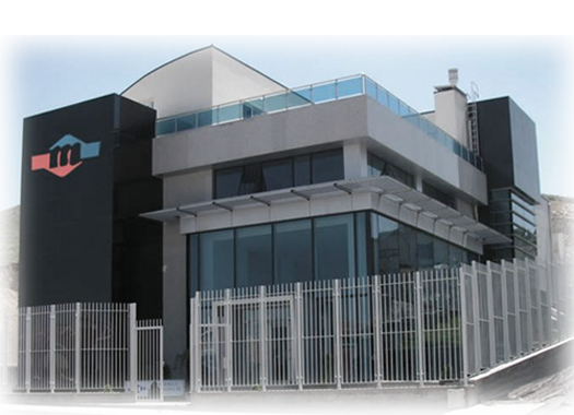 Being one of the most predominant engineering and consultancy companies in Turkey for over 33 years, it is Mescioglu’s core principle to successfully carry out all projects that it undertakes. This is backed by the company’s multi-disciplinary approach and capabilities provided by a staff of more than 150 highly qualified employees
As the only company in Turkey which offers surveying, photogrammetry, consultancy in infrastructure projects, GIS applications, energy and hydrology under one umbrella, Mescioglu continues to seek, evaluate and expand its project management, engineering design and consultancy services capabilities to its existing as well as new clients in Turkey and across the globe.
Mescioglu Engineering is a member of TMMM (Turkish Consultant Engineers and Architects Union), EFCA (European Federation of Engineering Consultancy Associations) and FIDIC (International Federation of Consulting Engineers), and proves its quality approach to services with TS-EN ISO 9001:2008 Quality Security certifications.
Click here to download our Company Profile...
Click here to download our Survey Department Brochure...

